• Products
    • VDS
      VDS

      Access VDS full commercial engine to store subsurface data that is cloud-ready and streamable for high-performance workflows.

    • FAST
      FAST

      Stream subsurface data from the cloud to your existing interpretation applications. Rapidly visualize large data volumes and run your applications faster than ever before.

    • InteractivAI
      InteractivAI

      Take full control of your subsurface data interpretation with an interactive deep learning tool.

  • Solutions
  • Services
    Consulting Services

    Solve your subsurface challenges with our software development and consulting services with expertise in deep learning.

  • Resources
    • Use Cases
      Use Cases

      See Bluware solutions in action helping geoscientists to better understand the subsurface.

    • Case Study Map
      Case Study Map

      Access a world map and click to view use cases in which Bluware technology is applied.

    • Resources
      Resources

      Get access to both geoscience and developer resources through videos, webinars, whitepapers, and more.

    • News
      News

      Get the latest news and information about Bluware.

    • Blog
      Blog

      Learn about the latest trends on geoscience, data science, AI, and more.

    • Support
      Support

      Get product support from our technical team.

  • Company
    • About
      About

      Bluware increases E&P workflow productivity through cloud solutions and deep learning, so geoscientists can deliver faster and smarter decisions about the subsurface.

    • Leadership
      Leadership

      With more than 20 years of experience delivering technology, we’re changing the industry one petabyte at a time.

    • Partnerships
      Partnerships

      Support for Bluware continues to grow. Learn about our strategic partners and alliances.

    • Events
      Events

      Check out the upcoming industry events we are participating in.

    • Careers
      Careers

      If you get excited by the thought of moving the needle and affecting change, rather than being another cog in the wheel, you should keep reading.

  • Contact
    Contact

    Are you ready to enter the next generation of subsurface data workflows?

The newest version of InteractivAI was released on August 27, 2024. With groundbreaking new features, InteractivAI 5 has the power to transform your existing workflows.
InteractivAI5-3Dviewer

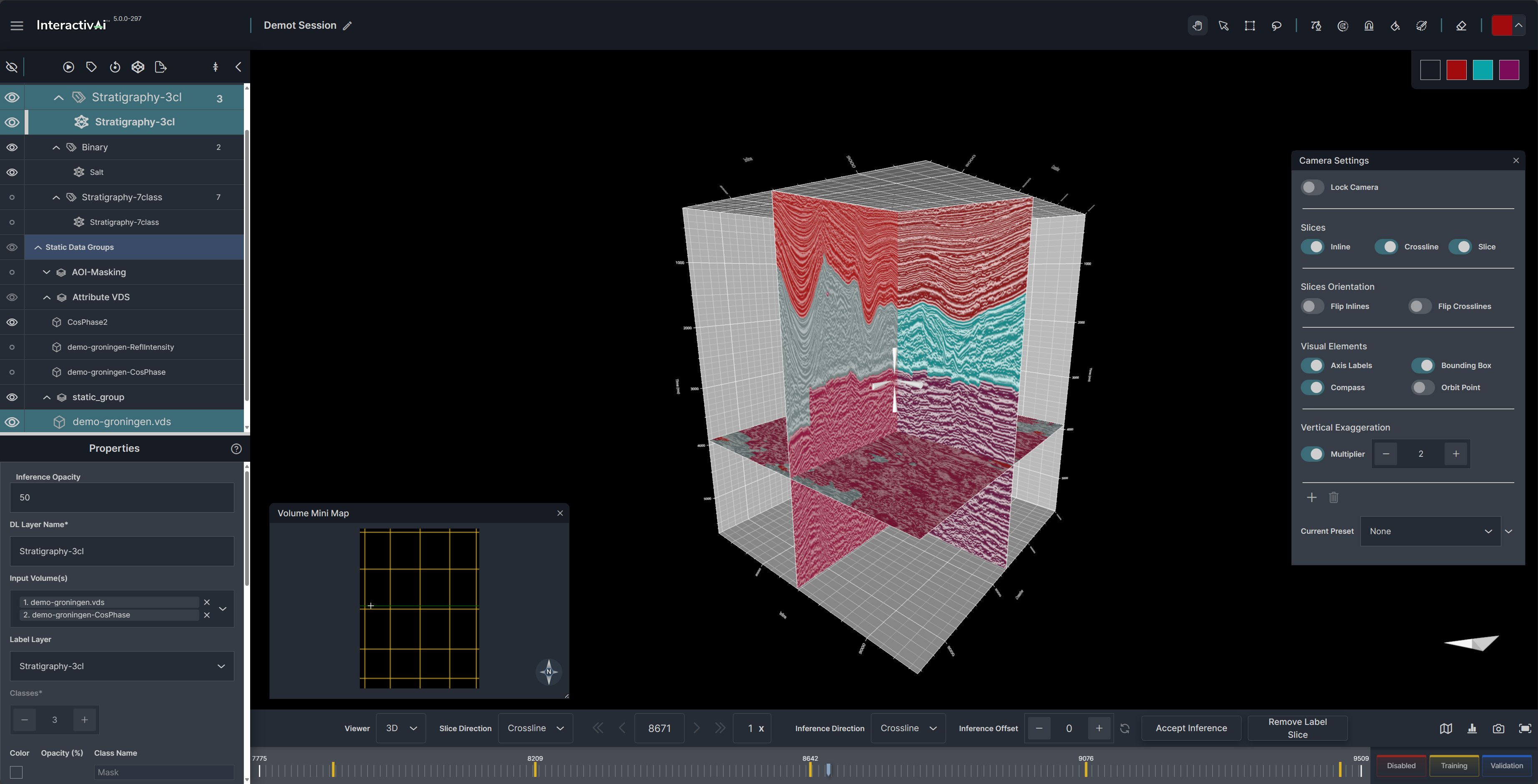
3D Viewer to Analyze 3D Problems

The 3D viewer will enable rapid and interactive navigation through your data. Easily jump to any inline, crossline, or z-slice in your survey for analysis and labeling. Explore, manipulate, and analyze seismic data effortlessly with intuitive view, zoom, pan, and rotate controls. Co-render multiple seismic and attribute data volumes, QC and analyze labels, and visualize machine learning inferences on seismic slices all in 3D.

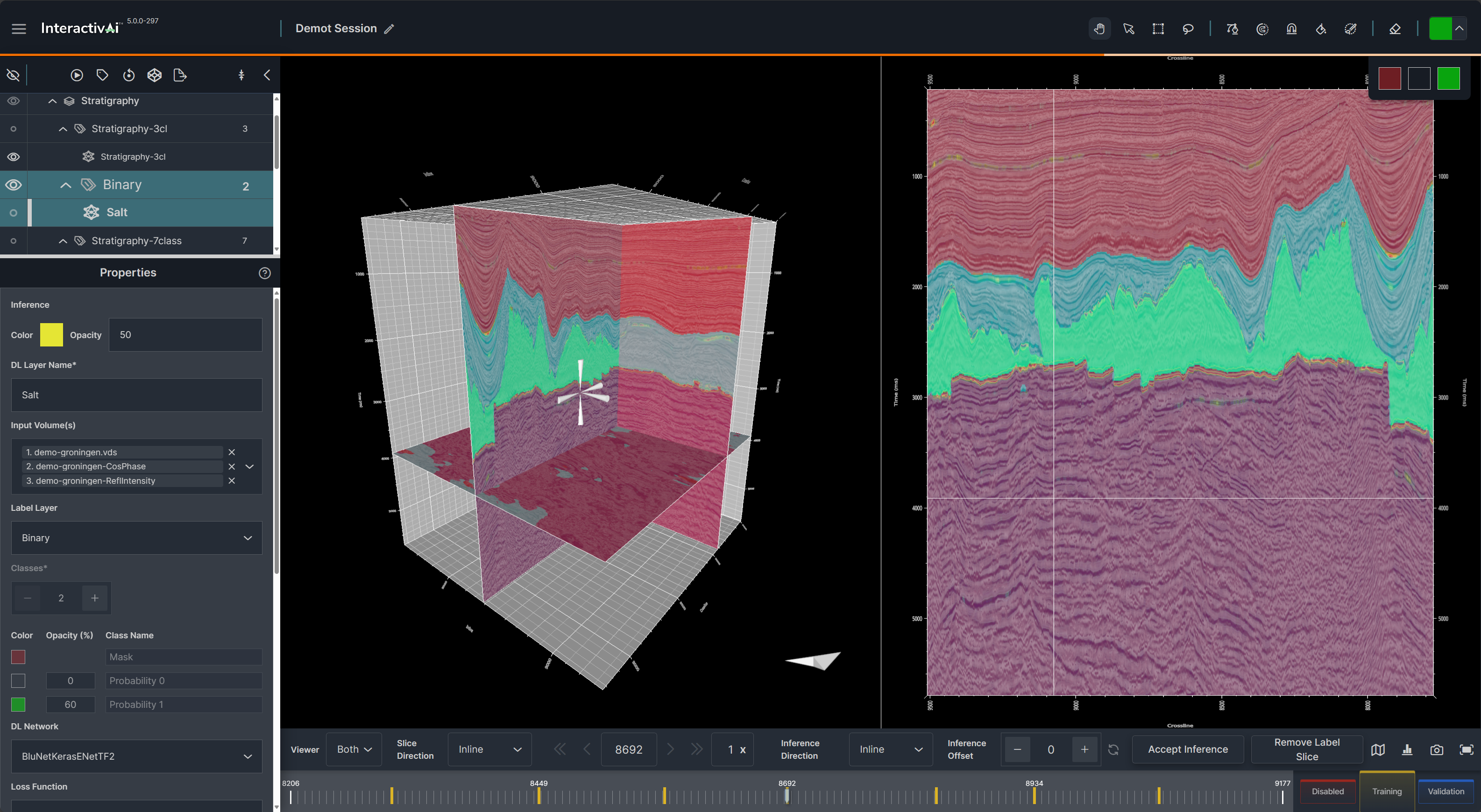
ISOLATE SPECIFIC COMPONENTS OF THE SEISMIC SIGNAL WITH MULTI-VOLUME TRAINING

The new multi-volume training capability leverages a single label set to train a neural network on up to three different data volumes simultaneously. This enables discovery of new attribute associations and relationships in your data by generating combined prediction results from complex seismic datasets. Integration of advanced geophysical products into the deep learning network such as AVO volumes, spectral component results, and inversion/QI volumes are a few examples of the exciting new capabilities enabled by InteractivAI 5.
Multi-Volume_Training_InteractivAI5
Enhanced_Label_Speed_InteractivAI5

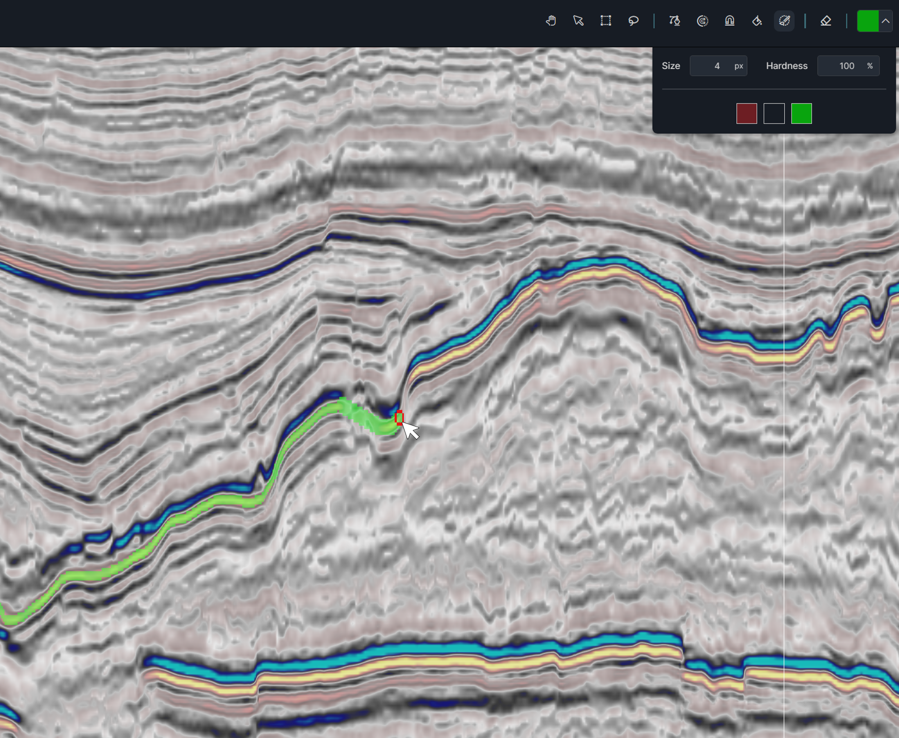
Spend more Time Training with Improved Label Speed

Spend less time painting and more time training with enhanced label persistence and fetching capabilities. Labels are rapidly displayed and incorporated into the training process for quicker network turnaround results.

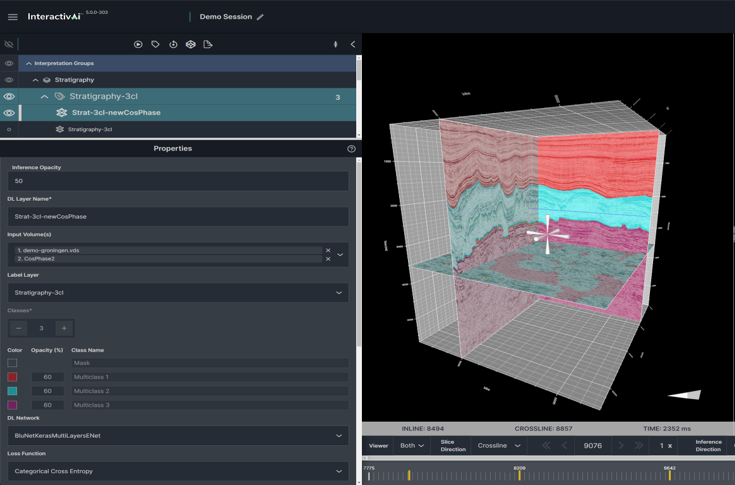
More control with UPGRADED Layers Panel

The upgraded layers panel will give you more control over the way that data is presented and managed, as well as an intuitive transition from layer information to layer properties.
LayersPanelIAI5
AOI_Masking_InteractivAI5_major_Bluware feature_final

IMPROVE ACCURACY WITH ENHANCED AOI Masking

Enhanced AOI mask functionality enables node-based editing, control over the definition of mask z-range, and visual improvements in the user interface. Change the AOI mask shape in real-time to enhance accuracy of the mask placement, draw important boundaries more precisely, and reduce the need for multiple AOI masks through interactive adjustments of boundary locations.

GENERATE MORE ACCURATE INTERPRETATIONS WITH INTERACTIVAI 5

Our geoscience experts can show you how this tool can fit into your existing workflows today.